Next step for Oldham section of GM Ringway walking trail sees signposts installed
Date published: 12 December 2023

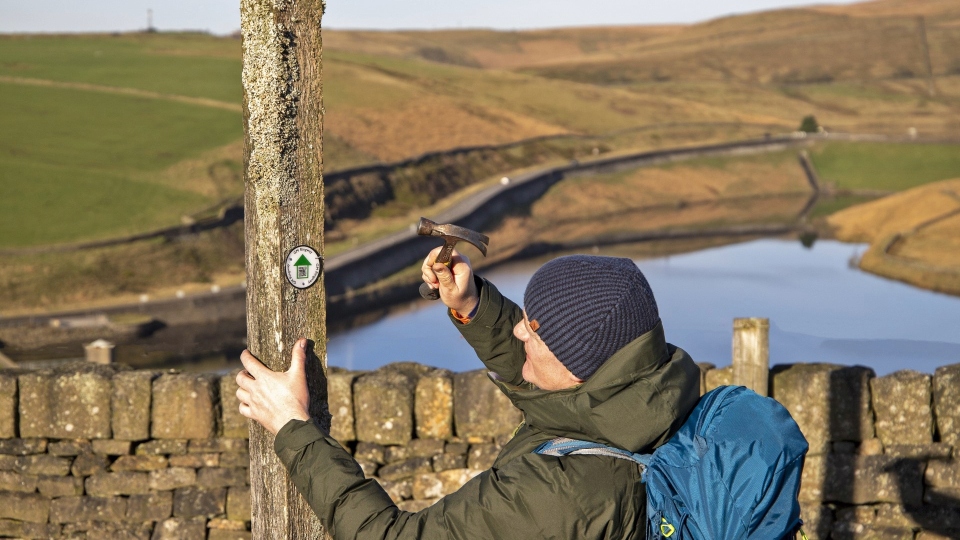
Volunteers have been out and about on Stage 9 from Greenfield to Newhey, just over the border in Rochdale, painstakingly marking out the 20-km (12.4-mile) stretch with more than 100 roundels
An Oldham section of the GM Ringway, Greater Manchester’s walking trail, is one of the first of the 20 stages to be signposted.
The trail section has been waymarked with small white discs – also known as ‘roundels’ – that point walkers in the direction of travel.
They also include a QR code that guides users to the GM Ringway website.
Volunteers have been out and about on Stage 9 from Greenfield to Newhey, just over the border in Rochdale, painstakingly marking out the 20-km (12.4-mile) stretch with more than 100 roundels.
They took over eight hours to complete the task in dry but chilly conditions.
Designed around existing footpaths, parks and open-access land Stage 9 allows walkers to explore the moorland landscapes of Saddleworth, the historical part of Pennine Yorkshire included within the Greater Manchester boundary.
Walkers start the section with a stroll along the Huddersfield Narrow Canal.
They also get to visit visit the picture-postcard hilltop village of Dobcross and enjoy aerial views of the Roman fort site at Castleshaw.
The route also includes a panoramic walk along the Standedge escarpment (part of the Pennine Way) as well as Crompton Moor and Crompton Fold, with its woodlands and waterfall.
Andrew Read, GM Ringway’s project lead, said: “It’s very exciting to see the GM Ringway roundels start to go up on posts, pillars, gates and stiles.
"It will make Greater Manchester’s walking route a lot easier to follow.
"We’re working hard to make sure anyone who wants to get out in nature and explore Greater Manchester’s great outdoors can do so without getting lost, by adding helpful waymarks with a handy QR code along the route.”
Designed around existing footpaths, parks and open-access land, the walking trail is divided into 20 stages starting and ending in Manchester city centre.
Green in every way, the entire 200-mile (323-km) GM Ringway is designed to be accessed by public transport.
Covering all ten boroughs of Greater Manchester, the trail explores an astonishing variety of landscapes, including parks, waterways and beautiful countryside.
In addition to its natural beauty, the GM Ringway also allows residents and visitors to explore Greater Manchester’s rich cultural heritage.
In addition, Go Jauntly – a free walking and wellness app – guides users along on the 20 stages of the trail, using pictures and route maps.
The app also includes ten shorter GM Ringway jaunts, including several step-free routes, enabling everyone to sample the trail.
Download the free-of-charge Go Jauntly app and own a pocket-sized encyclopaedia of urban walks here
The GM Ringway project is led by two charities – CPRE, the countryside charity, and The Ramblers (Greater Manchester and High Peak Area) – and is supported by a £250,000 Heritage Fund grant.
In addition, the project has received a £2,000 grant from Ramblers Holidays Charitable Trust and £10,000 from TfGM’s Cycle and Stride for Active Lives initiative.
Do you have a story for us? Want to tell us about something going on in and around Oldham? Let us know by emailing news@oldham-chronicle.co.uk , calling our Oldham-based newsroom on 0161 633 2121 , tweeting us @oldhamchronicle or messaging us through our Facebook page. All contact will be treated in confidence.


